
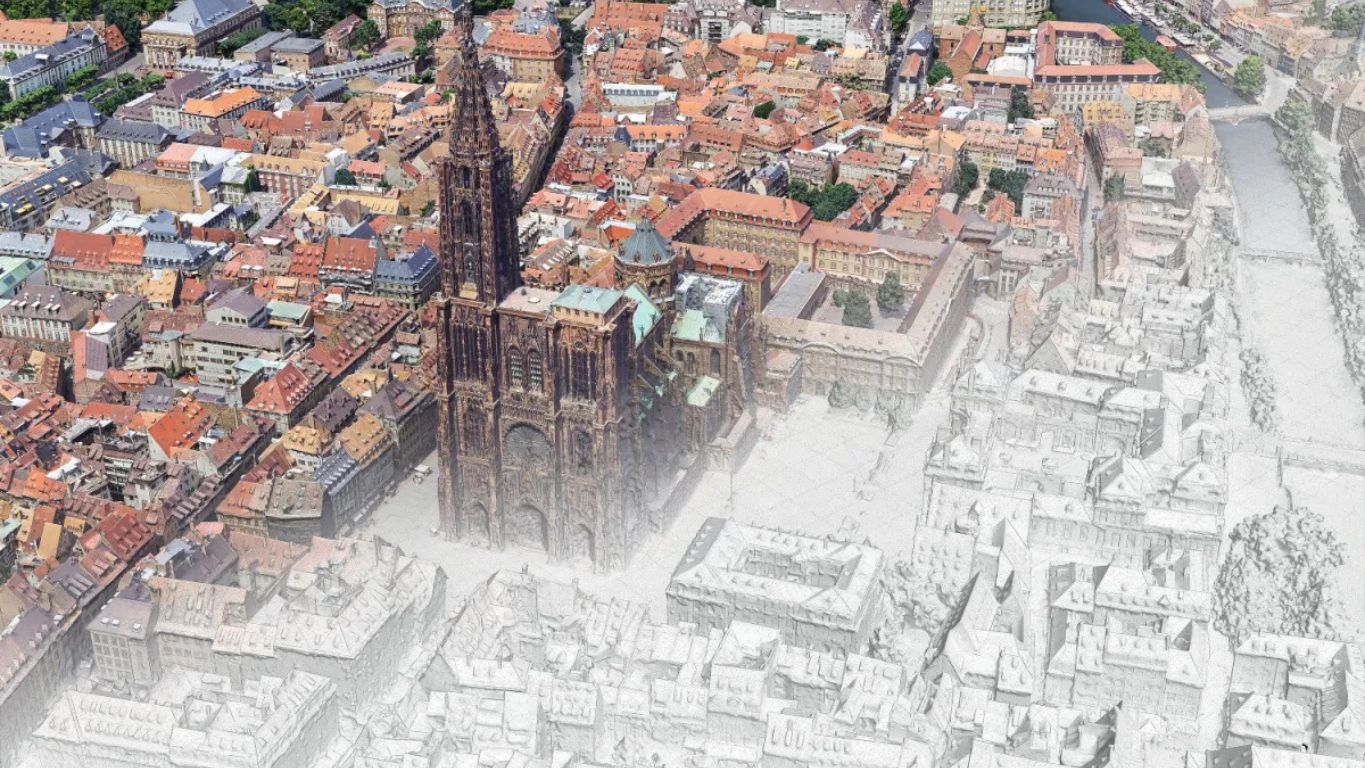
April 13, 2026 will remain a pivotal date in the history of the digital transformation of French territories. On that day, the State officially launched the JUNN, the National Digital Twin (Jumeau Numérique National), an unprecedented program that aims to virtually replicate the entire French territory to allow local authorities, state services, and economic players to visualize, simulate, and anticipate the developments of their living and working spaces.
Led by three major institutions — the IGN, Cerema, and Inria — the JUNN mobilizes 40 million euros over three years, including 25 million funded by France 2030 via the Banque des Territoires. This is not a research project. It is a national infrastructure, with a precise timetable and the first operational applications expected by late 2026.
Why did the State deem it necessary to act on this scale?
To understand the scale of the initiative, we must start from a simple observation: traditional land-planning tools are no longer sufficient.
French territories are facing challenges of unprecedented complexity. Climate change is redrawing the risk maps: floods, droughts, coastal erosion, urban heat waves. Natural hazards are intensifying and affecting areas previously spared. Pressure on water resources is reaching critical levels in several regions. And urban mutations are accelerating, under the combined effect of metropolization, the desertification of certain rural areas, and new mobilities.
Facing with these challenges, decision-makers need tools capable of answering questions that static maps and classic impact studies can no longer address: what happens if we build this neighborhood here? How will water resources evolve if temperatures rise by 2 degrees? What is the impact of a new transport infrastructure on air quality at the metropolitan scale?
Digital twins respond precisely to these needs. By faithfully reproducing the physical reality of a territory — such as its buildings, networks, relief, vegetation, flows — they make it possible to test scenarios before deciding, evaluate impacts before building, and anticipate crises before they occur. On one condition: that the data feeding them is reliable, precise, and continuously updated.
Promising but siloed initiatives
France did not wait for the JUNN to experiment with digital twins of territories. Several local authorities were pioneers. Bordeaux Métropole, the European Metropolis of Lille, Rennes Métropole, and the Vendée department have each developed their own tools, their own data models, and their own technical standards.
These initiatives proved the value of the concept. They also revealed a structural limit: their siloed nature. Each territory worked in isolation, with non-interoperable data, incompatible models, and investments that could not be mutualized. Under these conditions, it was impossible to simulate phenomena that do not stop at administrative boundaries, such as a flood, a drought, an epidemic, or a migratory flow.
This is precisely the problem the JUNN solves. By establishing a common technical foundation, interoperable data standards, and shared analysis services, it connects existing local initiatives and extends simulation capability to all local authorities, including the smallest, which lack the means or skills to develop their own digital twin.
A structured market, concrete opportunities
The launch of the JUNN does not just meet a public need. It structures a market.
By legitimizing investments in digital twins, creating a common framework, and mobilizing significant public funding, the State sends a clear signal to the entire ecosystem: immersive technologies and 3D modeling of territories are now national priorities. For private actors capable of producing the data and services that will feed this infrastructure, the window of opportunity is real and opens now.
The key role of 3D capture
A digital twin is only as relevant as the data that constitutes it. This is an obvious fact with very concrete consequences for the JUNN value chain.
The virtual modeling of a territory is not just declared. It is built from rigorous, precise, and regularly updated field data. And this is where high-precision 3D capture plays a fundamental role. Without modeling that is faithful to the physical reality of spaces — their geometries, their textures, their evolution over time — simulation remains approximate, and the decisions it is supposed to guide lose their relevance.
Gaussian Splatting, a technology that KLONA has mastered and deployed for several years, represents a major advance in this field. By producing 3D reconstructions of unmatched precision and realism from field photography, it allows digital twins to be fed with immersive data directly usable in simulation and visualization tools. This is precisely what we bring: the ability to model complex spaces with the fidelity that decision-making uses require.
The JUNN legitimizes this approach. It creates the framework in which our expertise takes on its full meaning.
The territory of tomorrow will be digital before it is built
The launch of the JUNN marks a turning point. Not a sudden revolution, but the culmination of a conviction that has progressively taken hold in the fields of territorial planning, risk management, and public policy: deciding without simulating is deciding blindly.
At KLONA, this moment confirms and reinforces the direction we have chosen. We help organizations model reality with precision so that the decisions shaping our territories are made with the best possible data.